Gallery
About this campground
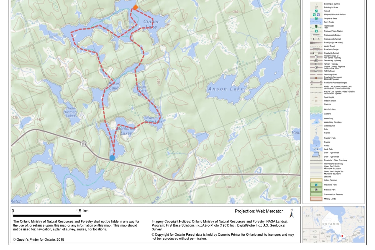
Technical Guide: Hwy 116 20 km from the junction of Hwy 118 and 35. Park in clearing south of the highway. Access to Bentshoe Lake via a 100 m portage To northwest corner of Bentshoe Lake P 325 m to south end of Poker Lake Follow north shore of Poker Lake to portage P 50 m to small weedy pond (swampy!) To north end of pond P 75 m to Quirt Lake (swampy) To most westerly bay of Quirt Lake P 75 m to Cinder Lake To most southerly bay of Cinder Lake P 175 m to small pond (swampy / overgrown) To south end of pond P 175 m to Poker Lake (wet and muddy) Across bay to next portage P 275 m to Upper Crane Lake To south end of Upper Crane Lake Liftover between Upper Crane Lake and Lower Crane Lake To west end of Lower Crane Lake P 300 m to Bentshoe Lake West on Bentshoe Lake Liftover at mid point of lake To south end of Bentshoe Lake P 100 m back to Hwy 118 to finish Maps Required Other Maps: Chrismar Adventure Map - Poker Lake Area (shows all portages, campsites, other useful information)
How to get to Poker Lake Route
-
Head towards the nearest highwayUse your preferred navigation app to reach the main highway leading to the region.
-
Exit towards Poker Lake, OntarioTake the signed exit and follow local road signs for Poker Lake Route.
-
Follow local access roadProceed carefully on the access road; conditions may vary seasonally.
-
Arrive at the entranceLook for the Poker Lake Route entrance sign and check in if required.
How to book Poker Lake Route
-
Check availabilityOn the Poker Lake Route page, select your dates to check availability.
-
Review detailsReview campsite details, rules, pricing, and cancellation policy before booking.
-
Complete bookingProceed to checkout, provide guest details, and confirm your reservation.
-
Receive confirmationYou will receive a booking confirmation with check-in instructions via email.